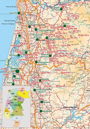
Hikes in the District Aveiro
The District Aveiro is located along the Atlantic Coast, south of Porto.
Because of wild fires in 2018, please check if the track is walkable before setting off.
The used appreviations are:
Albergaria-A-Velha (ABL), Agueda (AGD), Arouca (ARC), Castelo de Paiva (CPV), Estarreja (ETR), Ilhavo (ILH), Oliveira de Azemeéis (AOZ), Ovar (OVR), Sever do Vouga (SVV), Vale de Cambra (VLC)
Overview (for high-resolution please click on the map).
Costs Map and Track: The maps are free to download. However, we ask for a Donation of 0,50 Euro (or any higher amount!). This allows us to keep our team happy who create and update these maps.
You can donate simply with paypal:
| NUMBER_WIP | Name | Designation |
Area | Length (km) | Time | Link |
|---|---|---|---|---|---|---|
| {NUMMER_WIP} | {Name} | {Bezeichnung} | {Gebiet} | {Wege::Länge} | {Zeit} | {Link} |

